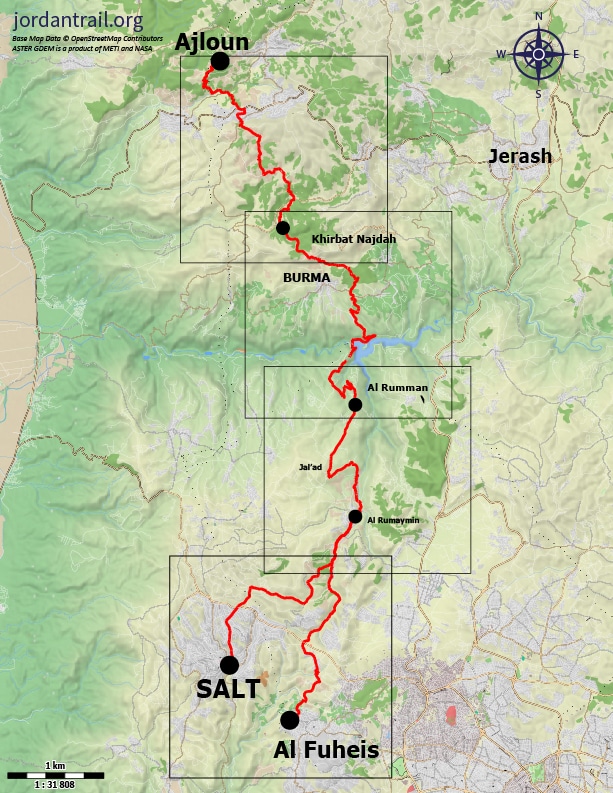
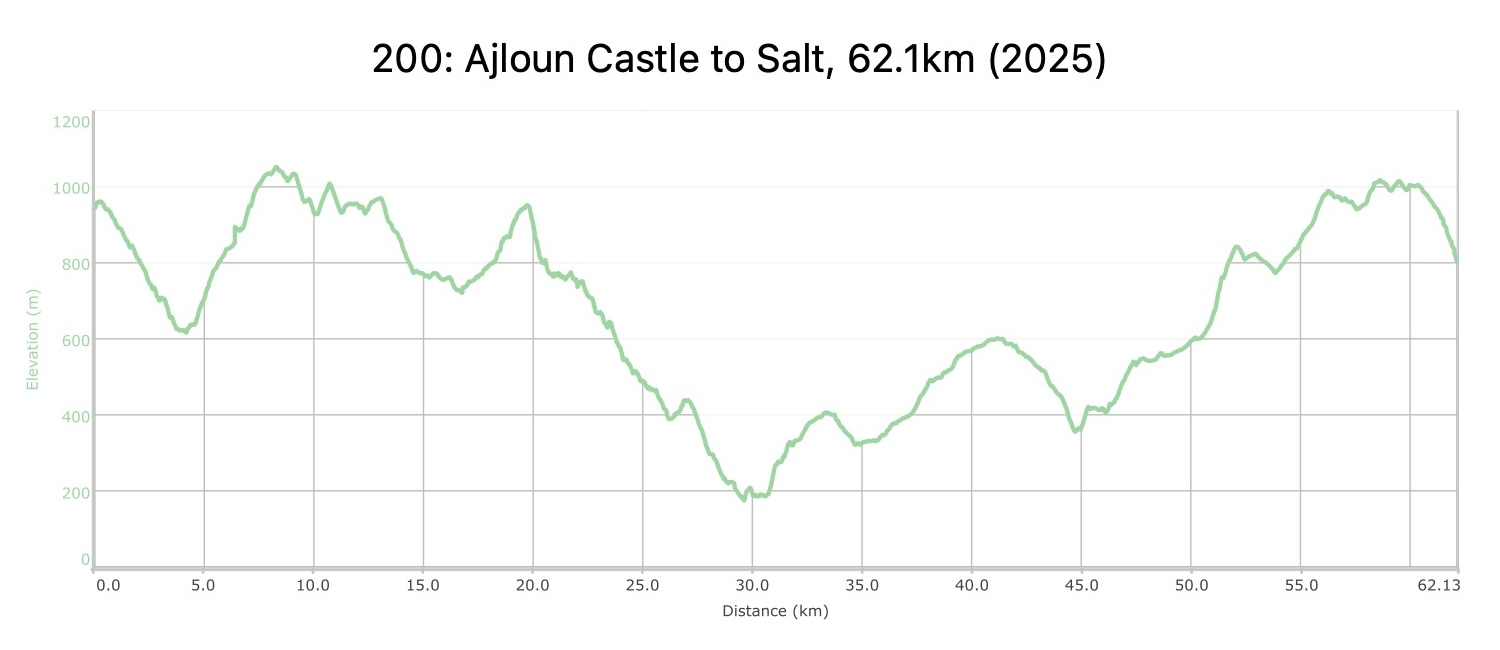
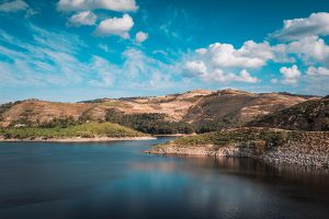
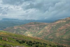
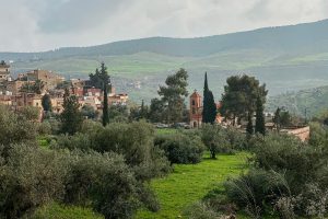
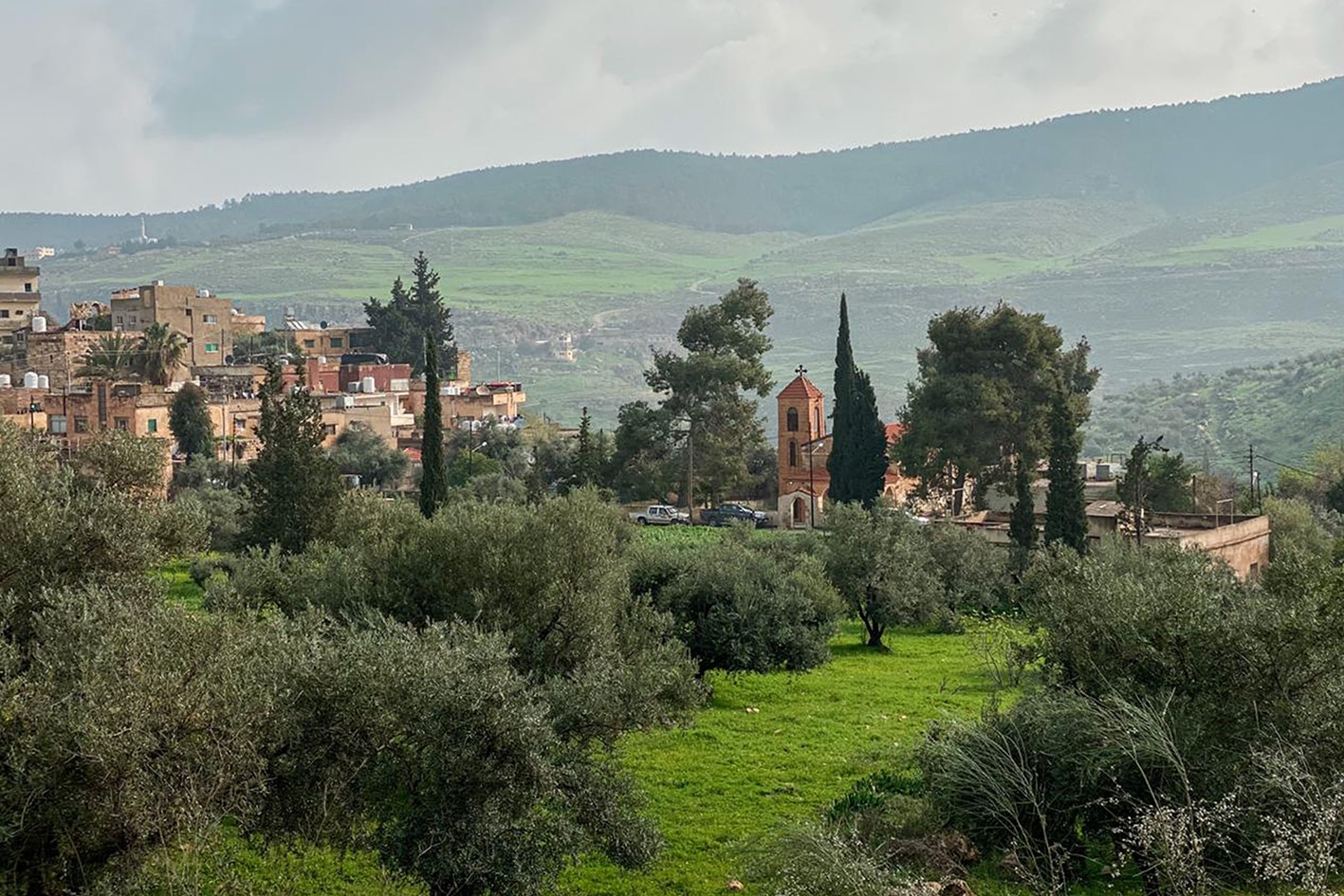
REGION 2: AJLOUN TO AS-SALT

  • Details

    From the village of Burma, the trail descends to the King Talal Dam and provides a view across the large expanse of water stretching eastward between forested shores. It then crosses the dam wall and ascends to a hilltop ridge, which it follows south past rich farmlands to the mixed Christian and Muslim village of Rmemeen with its café and neighboring church spire and minaret. Beyond, it follows a track up a narrow, winding agricultural valley, climbing near Ahliyya University to reach the city of Salt.

    4 days Lenth: 62.4 km

  • Main sites in the region:

  • Burma village

  • King Talal Dam

  • Rmeimeen village

  • Town of Fuheis & Carakale microbrewery

  • City of Salt


To download the GPS track,  Click here.. 
Click Icon

The Jordan Trail is a newly established trail, and is not marked. It is therefore our strong recommendation that you hire a local guide for your safety as many sections are remote with limited water sources and at times no connectivity.
By downloading these maps/GPX you take full responsibility for their use and accuracy; Jordan Trail Association does not warrant the accuracy or completeness of the information, materials or the reliability of any maps as they provided AS IS without warranty of any kind, either express or implied, including but not limited to, fitness for a particular purpose, or non-infringement ;You acknowledge that any reliance on any such maps, shall be at your sole risk and responsibility as Hiking, backpacking, and other outdoor activities all have potential hazards involving risk of injury or death. Outdoor activities have inherent risks and you should ensure you have the skill level and abilities suitable for the activities in Jordan to partake in them and to take all precaution measures.  Check the data on Google Earth or other Apps or Programs before using them.  The Jordan Trail Association shall not be held responsible for any incidents that may occur during your participation in any activity and/or by using any of the maps/GPX.
AGREE
close-link
to download the map

REGIONAL TRANSPORTATION

We’re still collecting this information. Do you know something that might be helpful?

For more information on transportation in Jordan, click here.

Accommodations

We’re still collecting this information. Do you know something that might be helpful? Share it with us!

The Jordan Trail is a newly established trail, and is not marked. It is therefore our strong recommendation that you hire a local guide for your safety as many sections are remote with limited water sources and at times no connectivity.
By downloading these maps/GPX you take full responsibility for their use and accuracy; Jordan Trail Association does not warrant the accuracy or completeness of the information, materials or the reliability of any maps as they provided AS IS without warranty of any kind, either express or implied, including but not limited to, fitness for a particular purpose, or non-infringement ;You acknowledge that any reliance on any such maps, shall be at your sole risk and responsibility as Hiking, backpacking, and other outdoor activities all have potential hazards involving risk of injury or death. Outdoor activities have inherent risks and you should ensure you have the skill level and abilities suitable for the activities in Jordan to partake in them and to take all precaution measures.  Check the data on Google Earth or other Apps or Programs before using them.  The Jordan Trail Association shall not be held responsible for any incidents that may occur during your participation in any activity and/or by using any of the maps/GPX.
AGREE
close-link