SECTION 501: AL-KARAK TO TOR AL-TABOUN

  • HIKES IN THE REGION

  • DAY 1: KARAK TO TOR AL-TABOUN

  • Distance: 27.1 km

  • Time: 8 hours

  • Physical Challenge: Easy

  • Trail Challenge: Easy

  • Waymarked: No

To download the GPS track, click icon  

The Jordan Trail is a newly established trail, and is not marked. It is therefore our strong recommendation that you hire a local guide for your safety as many sections are remote with limited water sources and at times no connectivity.
By downloading these maps/GPX you take full responsibility for their use and accuracy; Jordan Trail Association does not warrant the accuracy or completeness of the information, materials or the reliability of any maps as they provided AS IS without warranty of any kind, either express or implied, including but not limited to, fitness for a particular purpose, or non-infringement ;You acknowledge that any reliance on any such maps, shall be at your sole risk and responsibility as Hiking, backpacking, and other outdoor activities all have potential hazards involving risk of injury or death. Outdoor activities have inherent risks and you should ensure you have the skill level and abilities suitable for the activities in Jordan to partake in them and to take all precaution measures.  Check the data on Google Earth or other Apps or Programs before using them.  The Jordan Trail Association shall not be held responsible for any incidents that may occur during your participation in any activity and/or by using any of the maps/GPX.
AGREE
close-link
Click Icon to download the map
IMPORTANT NUMBERS

Tourism Police:

Hotline: 117777
What’s App: +962 7 7099 1814

* When contacting Tourism Police for emergency identify that you are hiking the Jordan Trail, state your nationality, location and map name & number.


JTA office: +962 6 461 0999

(Working Hours: 9:00 a.m. to 5:00 p.m., Sunday- Thursday)


BASIC INFO
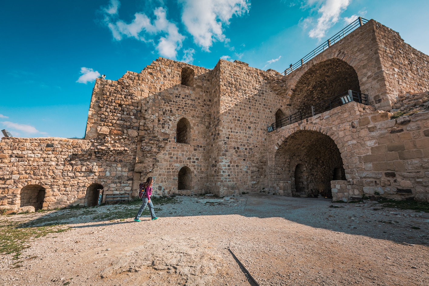
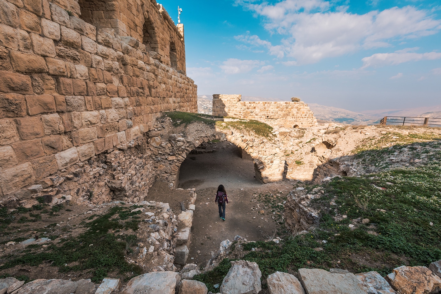
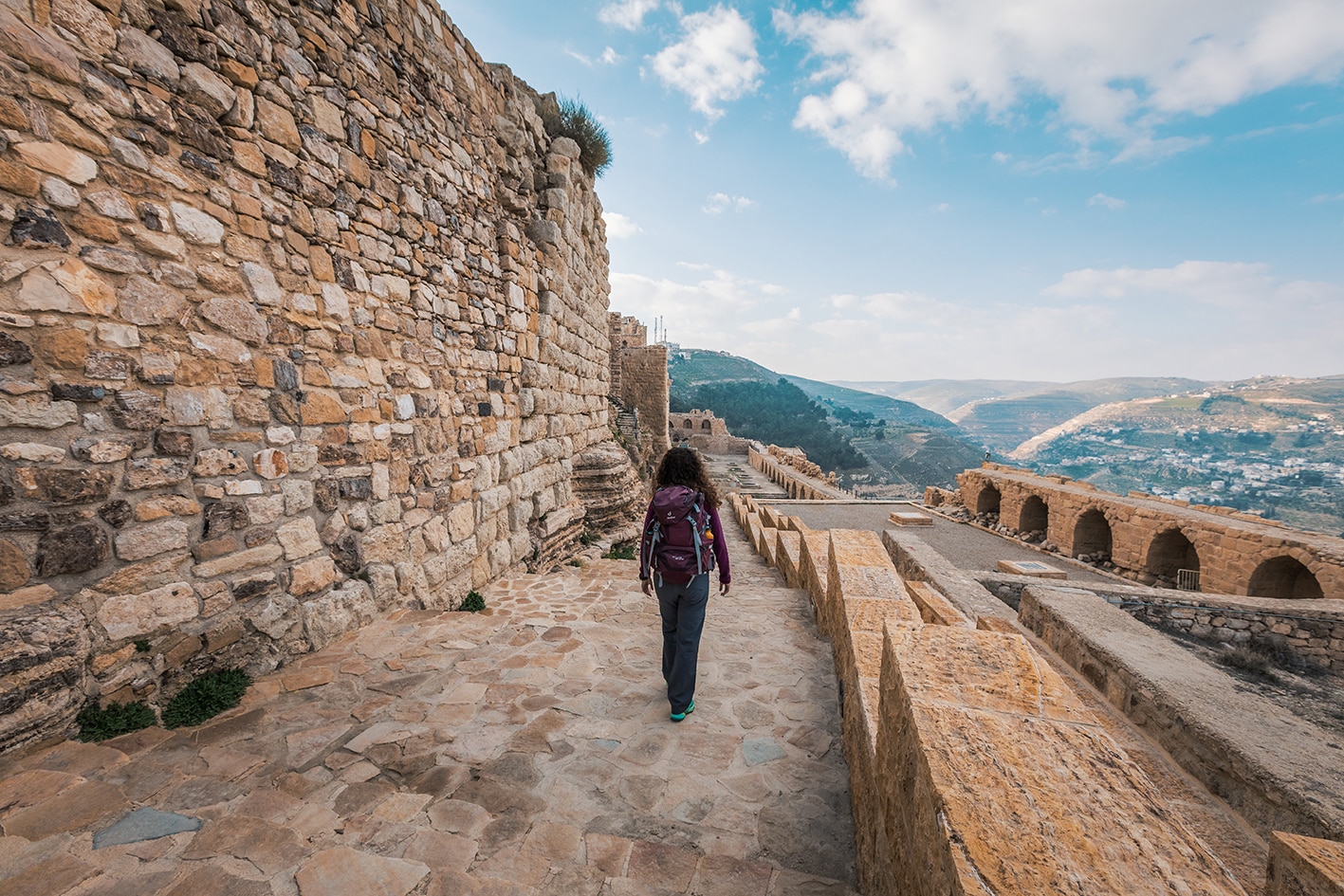
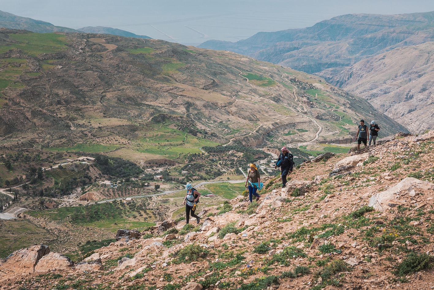
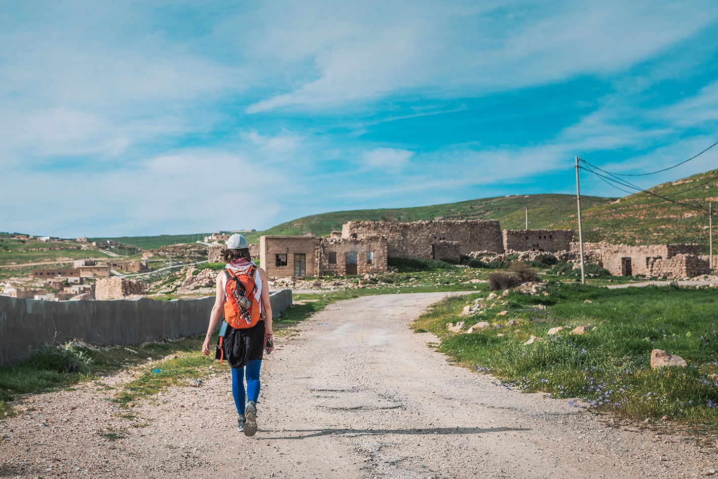
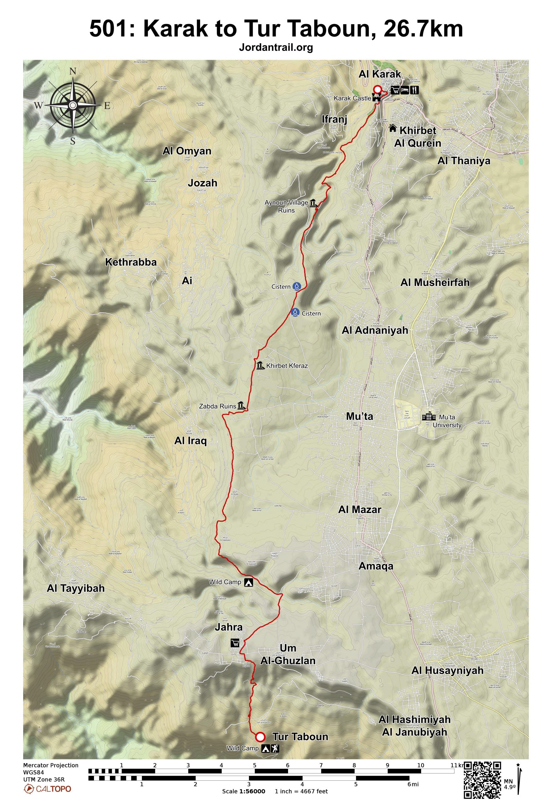
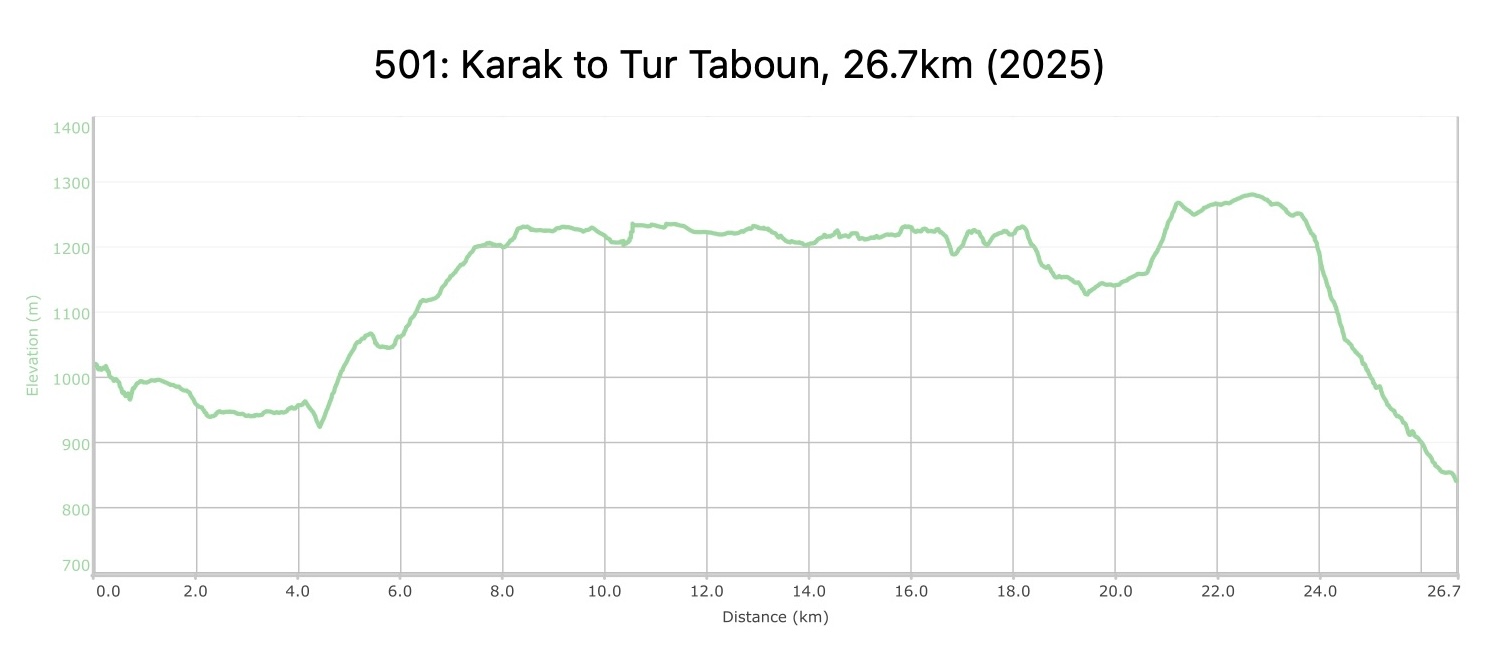
Leave the castle to head south on a good track high on the side of the impressively striated limestone valley of Wadi ed Dab’a (great views back to the castle and down the valley), eventually crossing the usually dry wadi before rising up to the almost abandoned village of Ainun located above an oxbow bend. (Take time out to explore.) Quiet country lanes then head SW over hills past more ruined villages to the edge of the plateau 1600 metres above the Dead Sea, and immediately overlooking the village of El Iraq. Follow a path along the edge to the village of Jahra and descend on paths to Tur Taboun.
TRANSTOPTATION
  • Buses go to Karak from Amman and Aqaba.
  • Many sections of this stage are accessible by vehicle.
LOCAL CONTACTS / ACCOMMODATAIONS
  • Wild Camping, Karam Alkhrisha,  +962 798372030, JT Pass Stamp: Tor Al Taboun
  • Home Stay, Asma Al Mahaneya,  +962 795188264
THINGS TO SEE
  • Kerak Castle
  • Ainun Village Ruins
  • Kferaz Ruins
  • Zijda Ruins
  • Al-Dabbakah
  • Jahra / Um Al-Ghuzlan
  • Nice views over the Dead Sea from Al-Iraq rim
  • Tur Taboun Cliffs and Rock Climbing
FOOD & WATER

Food:

  • Supplies are available in a variety of small villages along the stage.
  • It’s wise to stock up in Karak for a few days

Water:

  • Water can be obtained from random houses and farms in villages along the way. A small spring near Tor Taboun exists, but reliability should be confirmed.
TIPS & SAFETY

Tips:

  • It’s a long stage, but easy walking for most of it.
  • If self-supported, you can fill up water at various villages and seek camping at multiple points in stage. Be sure to have enough to get you to Burbeita at bottom of wadi 6km past Tor Taboun.
  • The trail down from Jahra village is a little slippery at places
  • Bathrooms available at the beginning in Kerak, in Hotels and restaurants.
  • ATM available at the beginning in Kerak City.

Safety Info:

  • Flash flood dangers – Mild risk in Wadi Mughair
  • Loose footing – A few sections coming down Jahra to Tor Taboun
  • Animals – various dogs along the way, possible to see dogs than people
  • Dehydration/heat exhaustion – Most of the route is around 1200m and cooler than lower elevations. Shade is limited.

The Jordan Trail is a newly established trail, and is not marked. It is therefore our strong recommendation that you hire a local guide for your safety as many sections are remote with limited water sources and at times no connectivity.
By downloading these maps/GPX you take full responsibility for their use and accuracy; Jordan Trail Association does not warrant the accuracy or completeness of the information, materials or the reliability of any maps as they provided AS IS without warranty of any kind, either express or implied, including but not limited to, fitness for a particular purpose, or non-infringement ;You acknowledge that any reliance on any such maps, shall be at your sole risk and responsibility as Hiking, backpacking, and other outdoor activities all have potential hazards involving risk of injury or death. Outdoor activities have inherent risks and you should ensure you have the skill level and abilities suitable for the activities in Jordan to partake in them and to take all precaution measures.  Check the data on Google Earth or other Apps or Programs before using them.  The Jordan Trail Association shall not be held responsible for any incidents that may occur during your participation in any activity and/or by using any of the maps/GPX.
AGREE
close-link