SECTION 701: PETRA TO GAA’ MRIEBED

  • HIKES IN THE REGION

  • DAY 1: PETRA TO GAA’ MRIEBED

  • Distance: 22.1 km

  • Time: 6-8 hours (not including detours)​

  • Physical Challenge: Difficult

  • Trail Challenge: Difficult

  • Waymarked: No

To download the GPS track, click icon  

The Jordan Trail is a newly established trail, and is not marked. It is therefore our strong recommendation that you hire a local guide for your safety as many sections are remote with limited water sources and at times no connectivity.
By downloading these maps/GPX you take full responsibility for their use and accuracy; Jordan Trail Association does not warrant the accuracy or completeness of the information, materials or the reliability of any maps as they provided AS IS without warranty of any kind, either express or implied, including but not limited to, fitness for a particular purpose, or non-infringement ;You acknowledge that any reliance on any such maps, shall be at your sole risk and responsibility as Hiking, backpacking, and other outdoor activities all have potential hazards involving risk of injury or death. Outdoor activities have inherent risks and you should ensure you have the skill level and abilities suitable for the activities in Jordan to partake in them and to take all precaution measures.  Check the data on Google Earth or other Apps or Programs before using them.  The Jordan Trail Association shall not be held responsible for any incidents that may occur during your participation in any activity and/or by using any of the maps/GPX.
AGREE
close-link
Click Icon to download the map

IMPORTANT NUMBERS

Tourism Police:

Hotline: 117777
What’s App: +962 7 7099 1814

* When contacting Tourism Police for emergency identify that you are hiking the Jordan Trail, state your nationality, location and map name & number.


JTA office: +962 6 461 0999

(Working Hours: 9:00 a.m. to 5:00 p.m., Sunday- Thursday)

BASIC INFO

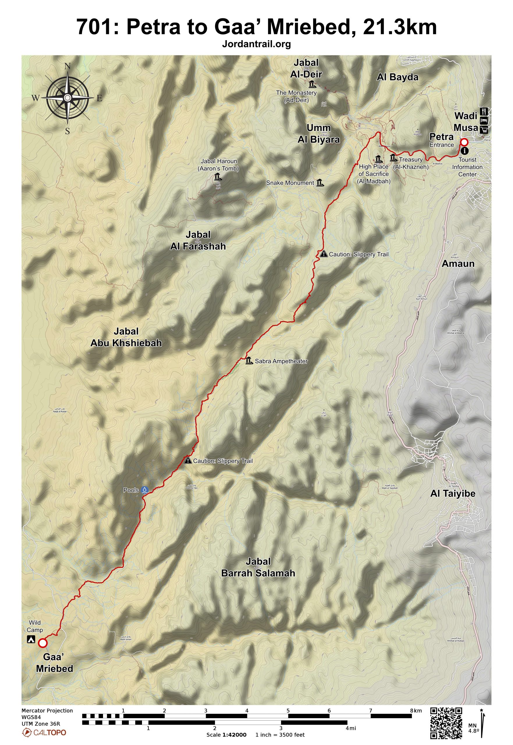
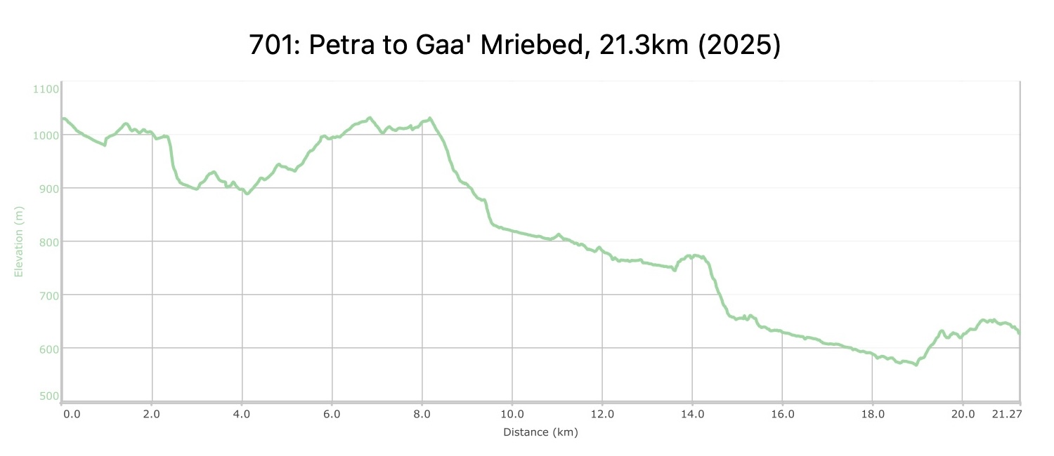
From the main Petra entrance and ticket office, head down the Siq to reach the famous Petra Treasury appearing through the narrow slot canyon. Continue around to the right and follow signs up to the “High Place of Sacrifice”, where you take a left turn up a set of stairs before reaching the Theater. Follow the winding steps all the way up to the ridge where the High Place of Sacrifice is accessible by a short footpath slightly off route to the right. Follow the well-developed trail down the other side following the sign for Wadi Farasa, passing the Lion Fountain and Garden Tomb.

Turn left off the main Petra trail onto a faint footpath (easy to miss, so GPS attention recommended). Follow this track as the path becomes more defined, turning south with large rugged mountains on your left. Continue on to the flatter area known as “Stuah Nebi Haroun” with its cultivated fields. Find and follow an old Roman Road heading down to your left along the ridge on the east side above Wadi Sabra, zigzagging down to the valley floor. Continue straight along the wadi, finding the easiest walking surface either along the side or the wadi bed. Reach the Sabra Amphitheater at 11.7km, a good place to take a rest.

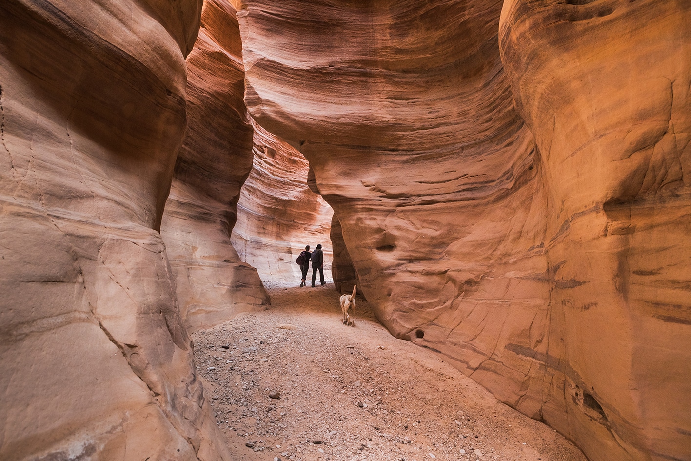
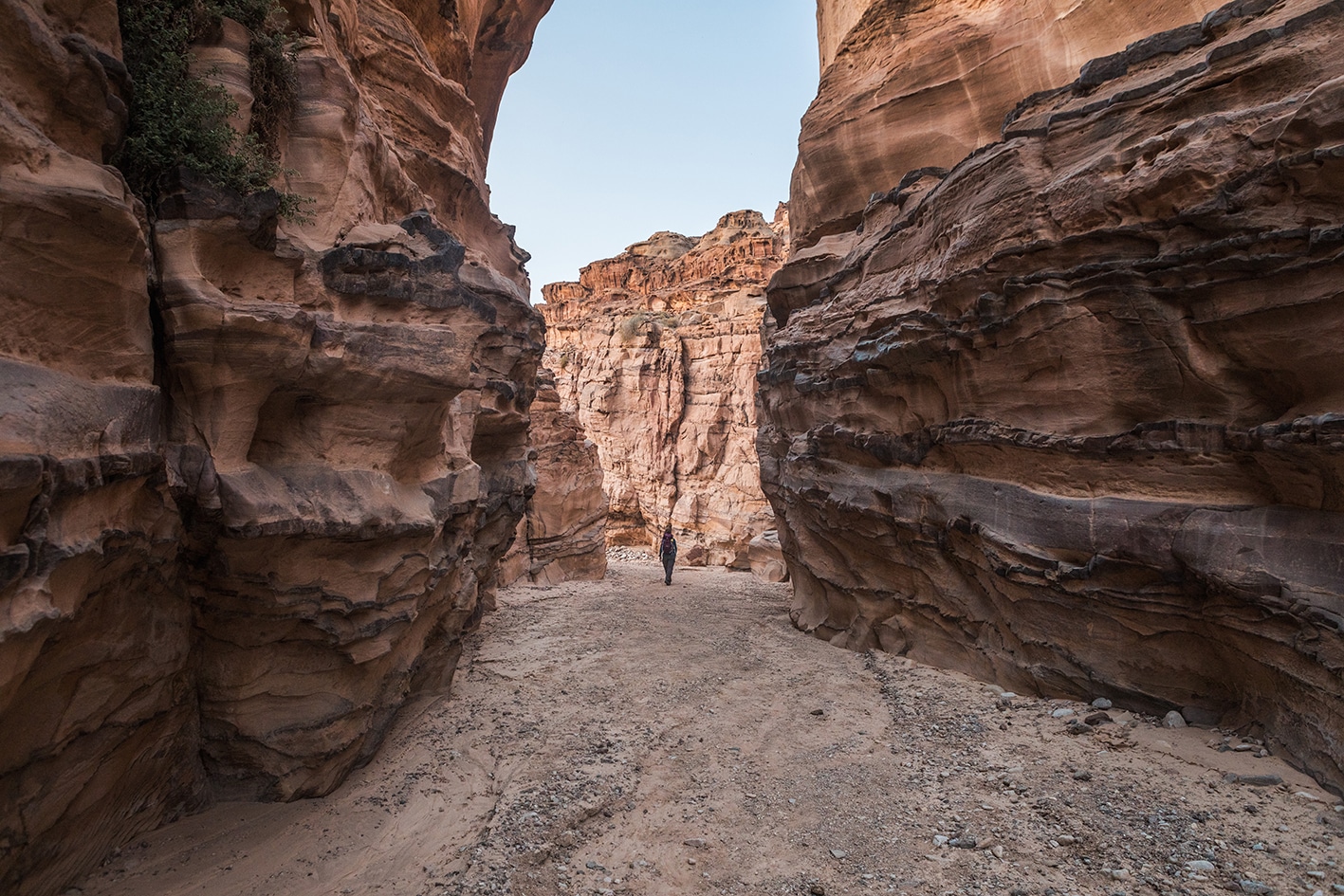
From the Sabra amphitheater, continue along the way and cross to the west side of the wadi, passing through crumbling ruins of a fortress, with the path starting to erode away (if easier, stay down in wadi). Continue down Wadi Sabra as it deepens and the rock walls on either side rise higher and higher. Pass through areas of white sandstone, and pay close attention to find cairns on the right side marking a faint donkey path winding up the right side of the wadi, which provides a way around the massive dry waterfall in the wadi below. Take care on this path as it’s high above the wadi floor and can be a little rocky, but overall is a well-built trail and is even passable by a donkey. Follow this breathtaking path to see the huge view of the wadi’s drop near the waterfall, and continue along the side of the wadi for a section until the valley starts to open up, and the path follows closer to the wadi bed. More plants and a wet section of the wadi could provide water in an emergency, but be sure to filter before drinking.

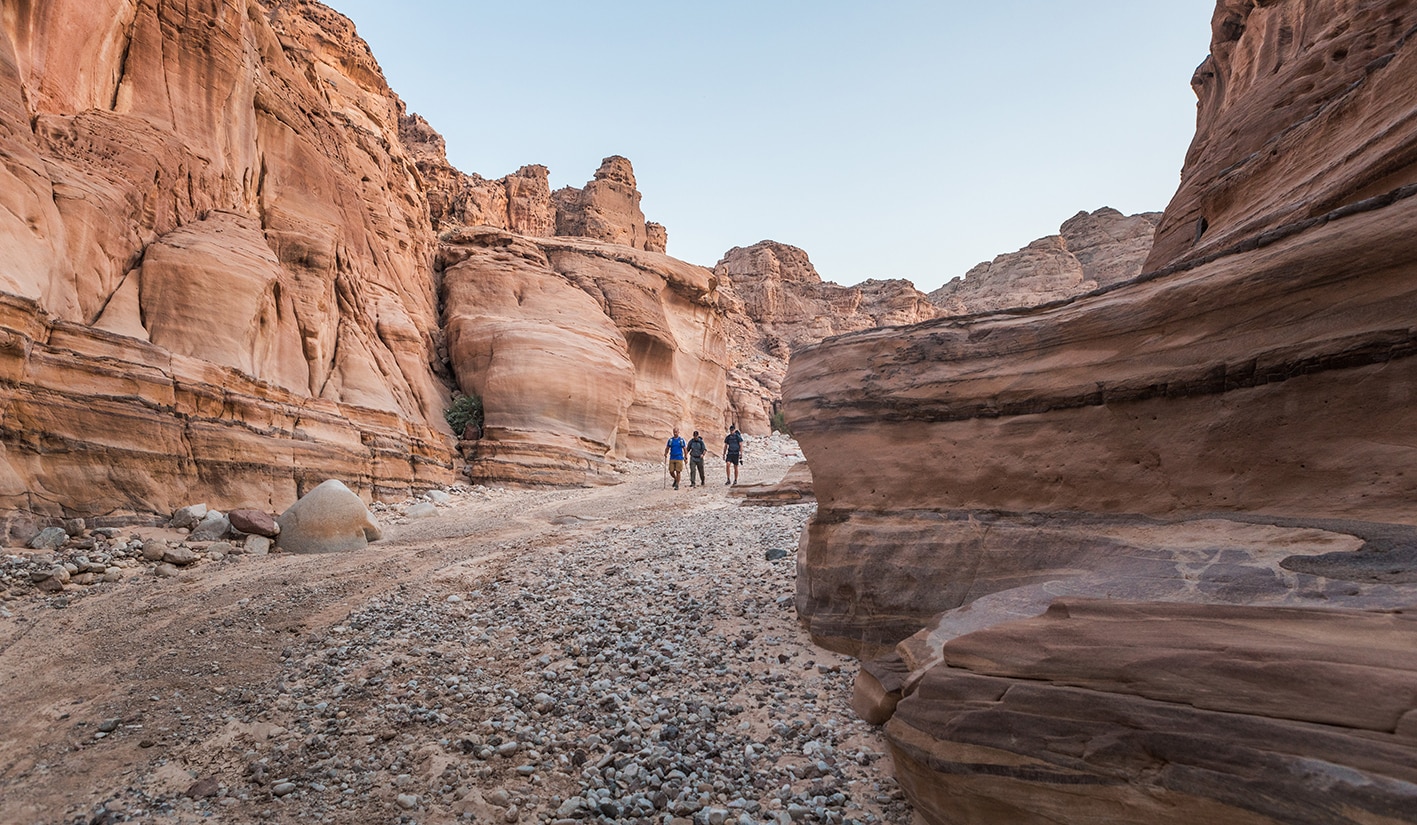
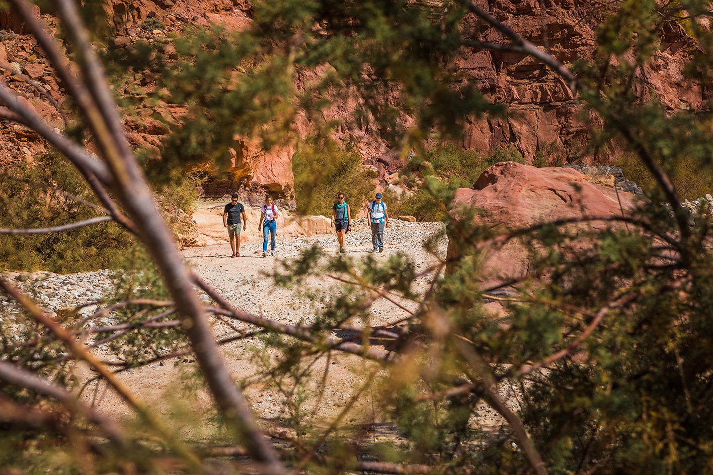
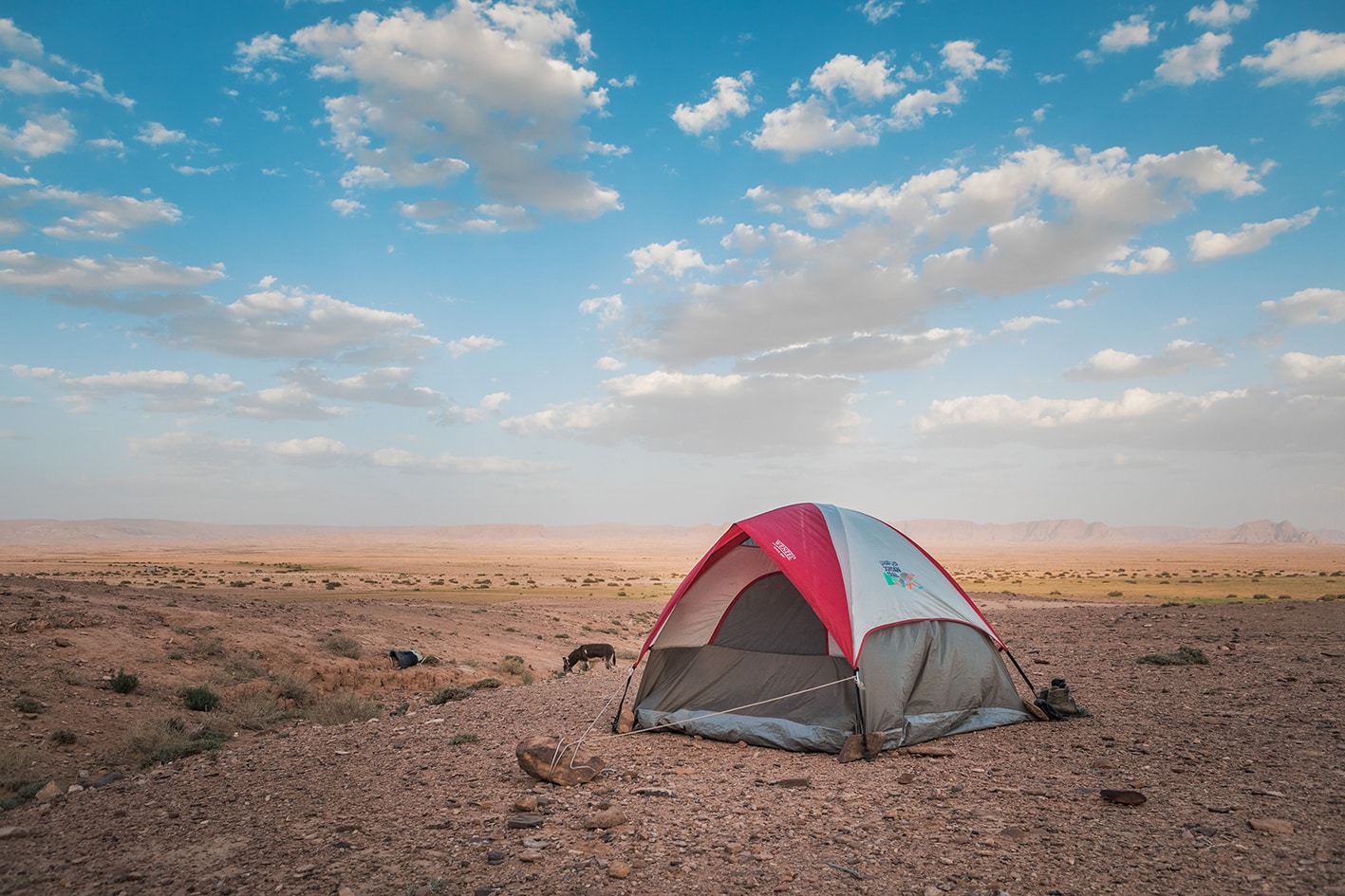
Follow the main route of Wadi Sabra for approximately 3km, and take the best walking path you find along the way, which changes between the sides of the wadi and the wadi bed. When you see a 4×4 track rising steeply out the east/left side of the wadi, take this track up and head more southwest across small gulleys, leaving and crossing the 4×4 track and a paved road to reach the campsite in the area called Gas’ Mriebed, near scattered bedouin camps and areas growing crops nearby. The area is accessible by the paved road from Wadi Musa, which takes 1.5 hours each way.


Important Note:

Entry to Petra requires a pass, which can only be purchased at the front entrance.  This route does not approach Petra through this entrance, so a pass must be purchased in advance.

TRANSTOPTATION
  • Jeep access is possible to the Snake Monument area from Wadi Musa
  • No public transport to Gaa’ Mriebed, but road access exists.
  • Public buses connect Amman’s southern bus station to Wadi Musa, or a private taxi runs around 50JD (agree on price beforehand)
  • Public minibuses leave from the Aqaba bus station to Wadi Musa in the morning and early afternoon. To return to Aqaba, check with your accommodations in Wadi Musa about the mini bus schedule. A private taxi one-way runs around 40JD.
Local Contacts / Accommodation
  • Wild camping, Mahmoud Abdulsalam (Habu), +962778332061,  JT Pass Stamps Little Petra, Gaa' Mriebed, and Petra
THINGS TO SEE
  • Petra
  • Wadi Sabra and amphitheater
  • Gaa’ Mreibid Mudflats
FOOD & WATER

Food:

  • Food is available at supermarkets in Wadi Musa and at restaurants/snack shops in Petra. No food resupply is available on route until the village of Humeima a few days ahead.

Water:

  • Water is available at Petra, and natural water can be taken from the pools in
  • Wadi Sabra if necessary (purification required).
TIPS & SAFETY

Tips:

There are multiple routes to exit Petra, including the easier to follow 4×4 route past the snake monument. This Jordan Trail’s chosen is a nice footpath that utilizes the Roman Road track down to Wadi Sabra.

If you’re severely scared of heights, you might want to take a wider, easier main path through Petra. The mapped route via the High Place of Sacrifice has few ancient staircases with moderate drop offs on the side.

Wadi Sabra has some parts of the trail exposed high up on the wadi side, but has been reported fine for most groups walking the route. Boots are important as there many rocks in the wadis.

Safety Info:

  • Exposed edges – The old donkey path bypassing above dry waterfall is a bit exposed, but not too scary. This area may challenge those with a fear of heights, as well as some staircases coming down from the High Place of Sacrifice that have some drops on the sides without guardrails
  • Flash flood dangers – Wadi Sabra
  • Loose footing – The trail along the wadi very rugged, and can be slippery when wet.
  • Dehydration/heat exhaustion – This region can be very hot, and some shade can be found from high wadi walls. As it’s a long stage, start early to avoid the heat.

The Jordan Trail is a newly established trail, and is not marked. It is therefore our strong recommendation that you hire a local guide for your safety as many sections are remote with limited water sources and at times no connectivity.
By downloading these maps/GPX you take full responsibility for their use and accuracy; Jordan Trail Association does not warrant the accuracy or completeness of the information, materials or the reliability of any maps as they provided AS IS without warranty of any kind, either express or implied, including but not limited to, fitness for a particular purpose, or non-infringement ;You acknowledge that any reliance on any such maps, shall be at your sole risk and responsibility as Hiking, backpacking, and other outdoor activities all have potential hazards involving risk of injury or death. Outdoor activities have inherent risks and you should ensure you have the skill level and abilities suitable for the activities in Jordan to partake in them and to take all precaution measures.  Check the data on Google Earth or other Apps or Programs before using them.  The Jordan Trail Association shall not be held responsible for any incidents that may occur during your participation in any activity and/or by using any of the maps/GPX.
AGREE
close-link