SECTION 702 :GAA’ MRIEBED TO WADI AL-SAIF

  • HIKES IN THE REGION

  • DAY 2: GAA’ MRIEBED TO WADI AL-SAIF

  • Distance: 14.3 km

  • Time: 4 - 5 hours ​

  • Physical Challenge: Easy

  • Trail Challenge: Moderate

  • Waymarked: No

To download the GPS track, click icon  

The Jordan Trail is a newly established trail, and is not marked. It is therefore our strong recommendation that you hire a local guide for your safety as many sections are remote with limited water sources and at times no connectivity.
By downloading these maps/GPX you take full responsibility for their use and accuracy; Jordan Trail Association does not warrant the accuracy or completeness of the information, materials or the reliability of any maps as they provided AS IS without warranty of any kind, either express or implied, including but not limited to, fitness for a particular purpose, or non-infringement ;You acknowledge that any reliance on any such maps, shall be at your sole risk and responsibility as Hiking, backpacking, and other outdoor activities all have potential hazards involving risk of injury or death. Outdoor activities have inherent risks and you should ensure you have the skill level and abilities suitable for the activities in Jordan to partake in them and to take all precaution measures.  Check the data on Google Earth or other Apps or Programs before using them.  The Jordan Trail Association shall not be held responsible for any incidents that may occur during your participation in any activity and/or by using any of the maps/GPX.
AGREE
close-link
Click Icon to download the map
IMPORTANT NUMBERS

Tourism Police:

Hotline: 117777
What’s App: +962 7 7099 1814

* When contacting Tourism Police for emergency identify that you are hiking the Jordan Trail, state your nationality, location and map name & number.


JTA office: +962 6 461 0999

(Working Hours: 9:00 a.m. to 5:00 p.m., Sunday- Thursday)


BASIC INFO

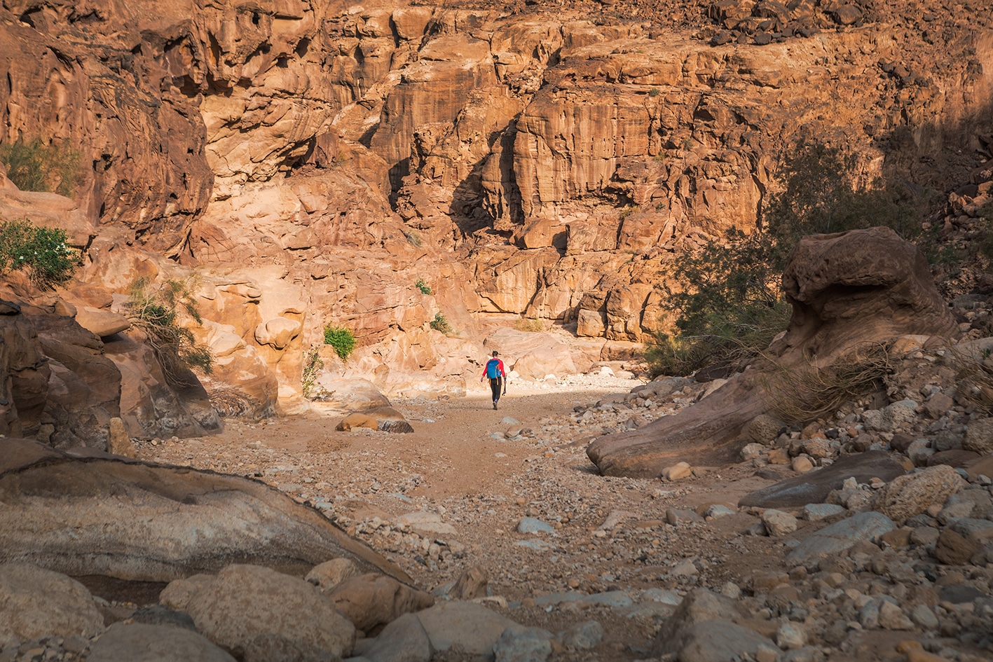
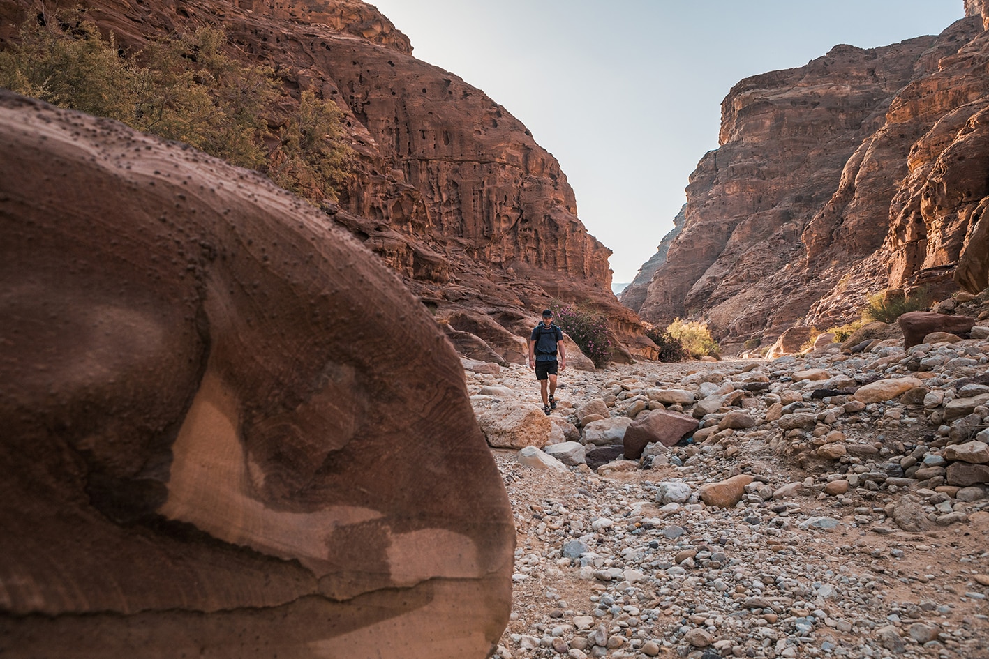
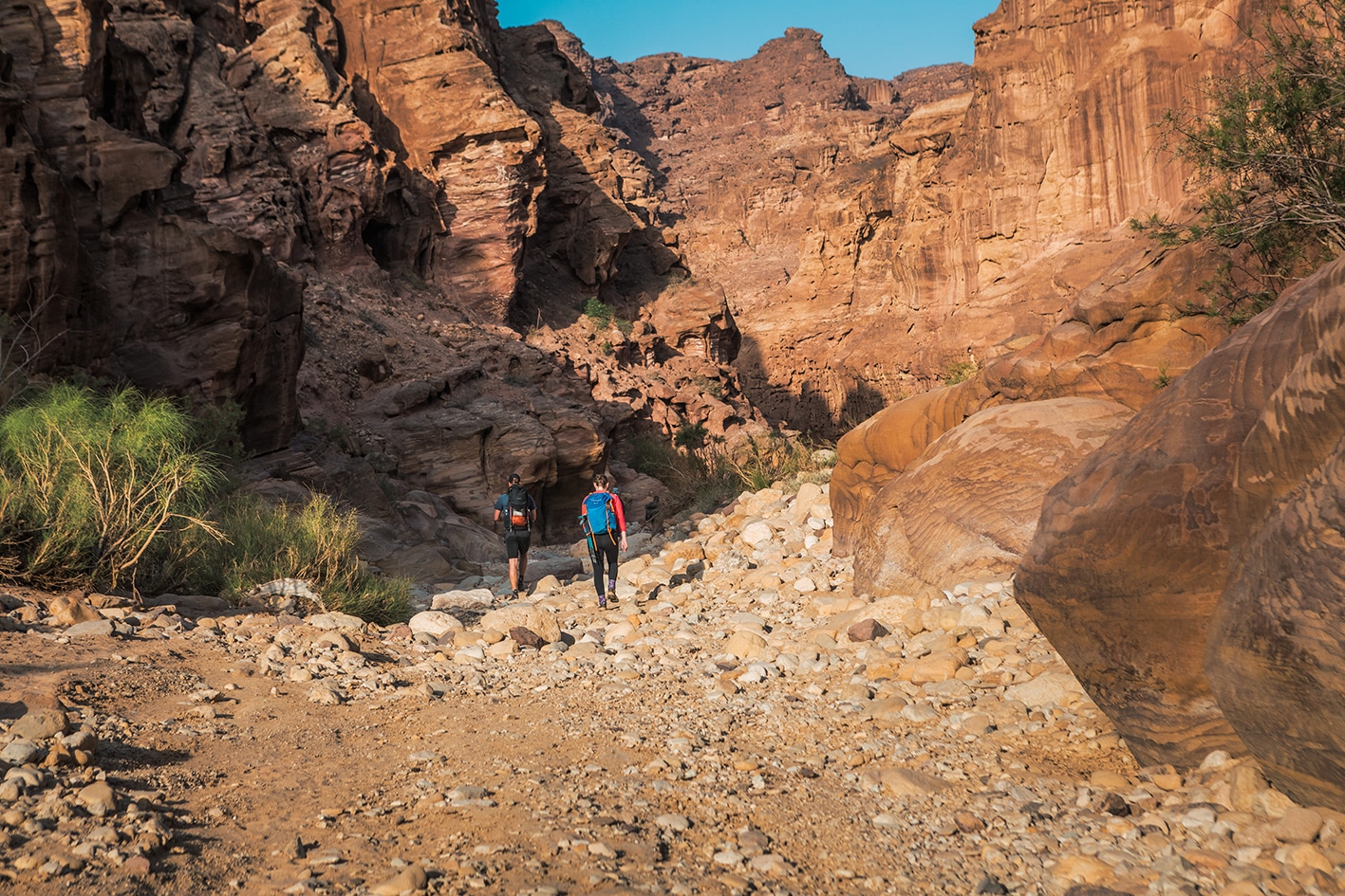
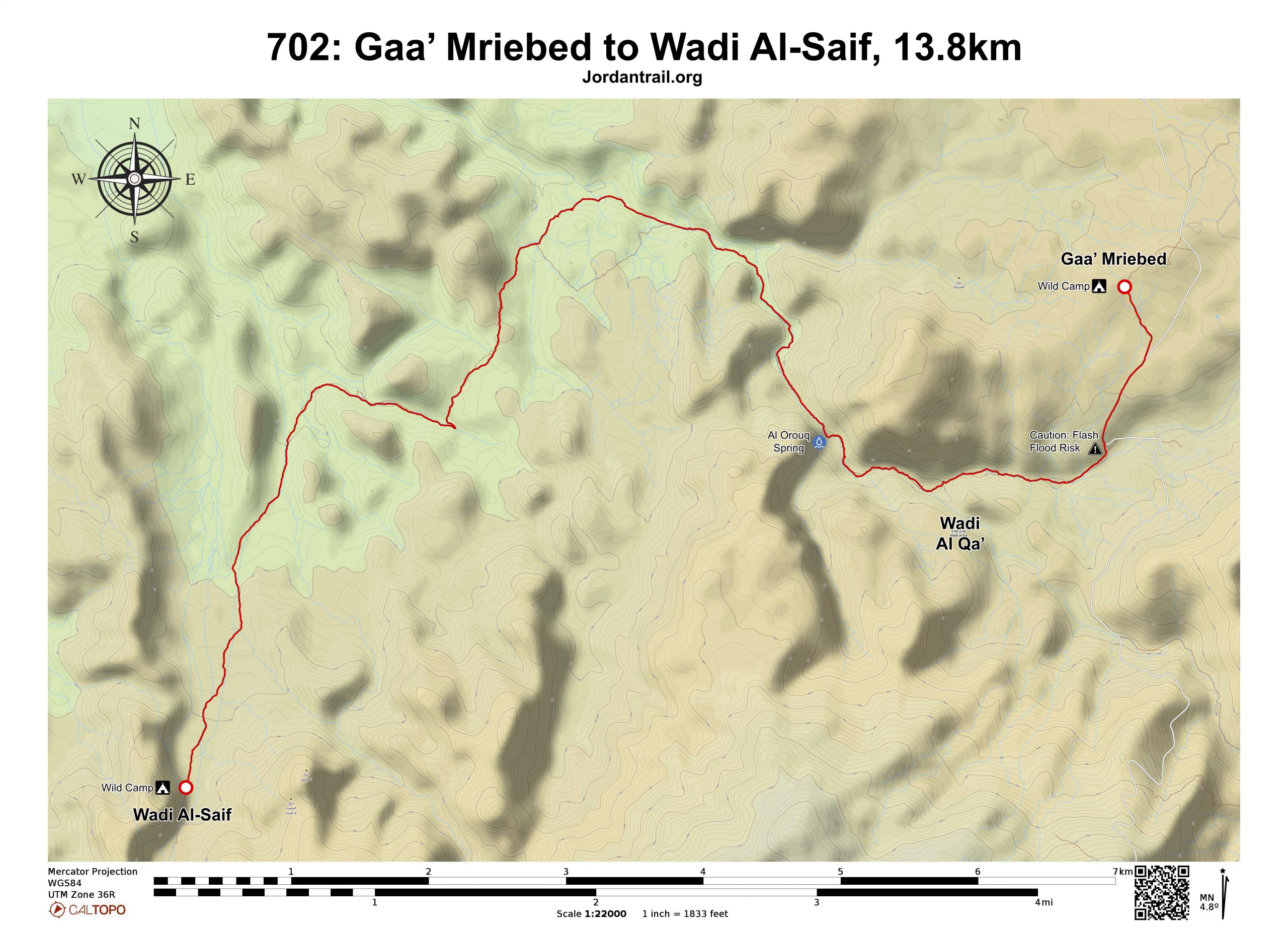
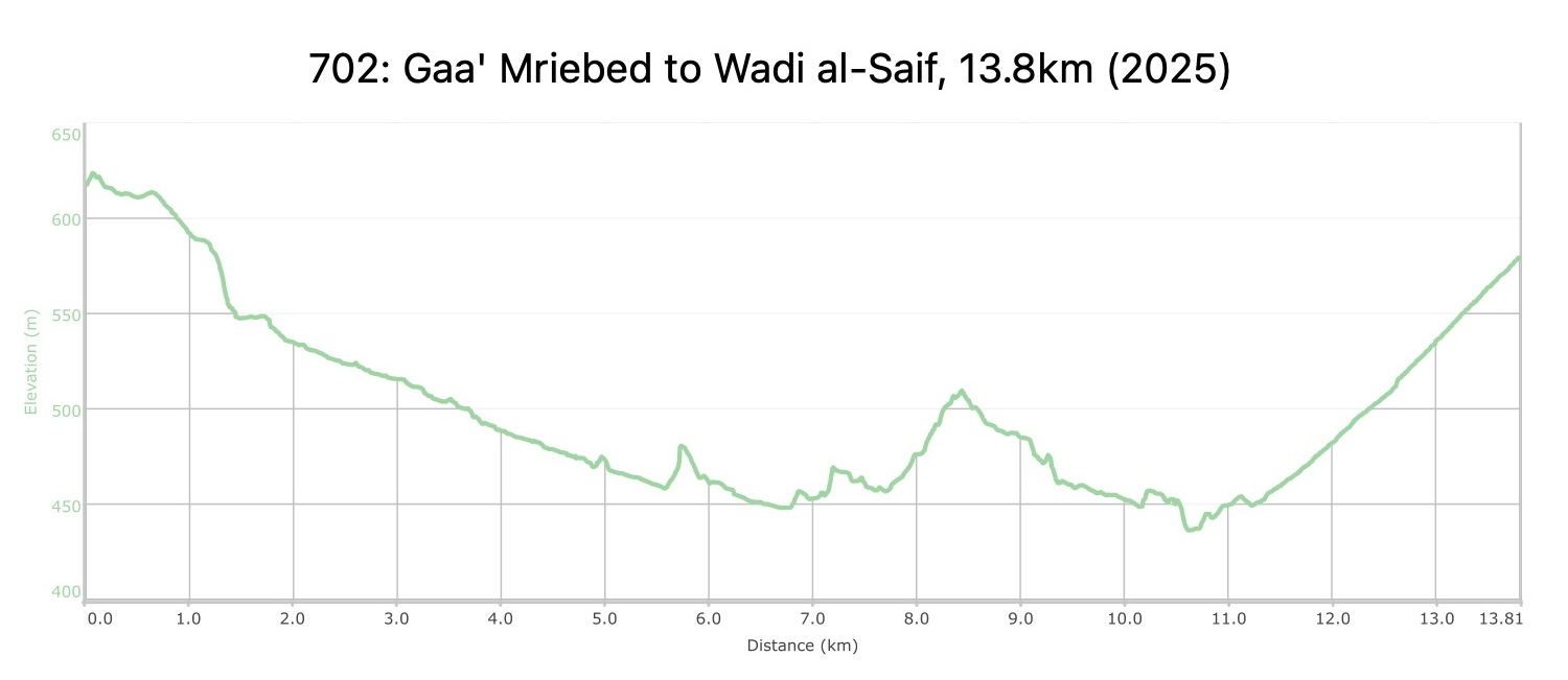
From Gaa’ Mriebed, head southwest downhill on the paved road, entering Wadi Abu O’rouq by turning right before a small bridge where the paved road crosses the wadi. Continue downhill in the wadi, through beautiful colorful sandstone, walking along the rocky wadi bed and through oleander plants. At around 3km, a larger wadi joins from your left, stay straight in main wadi. Pass through large sandstone boulders, and reach the underground-fed spring Ain al-O’Rouq, with water all year. If just a trickle, dig down into the wet sand. Continue along the wadi as it widens.

After a square cement cistern on your right, turn left and head west, then south, winding through a maze of rocky areas and gullies to reach a donkey track heading south. Continue on this better path until reaching a wadi entering from the east near a large shade tree and terraced wall at 9.8km.

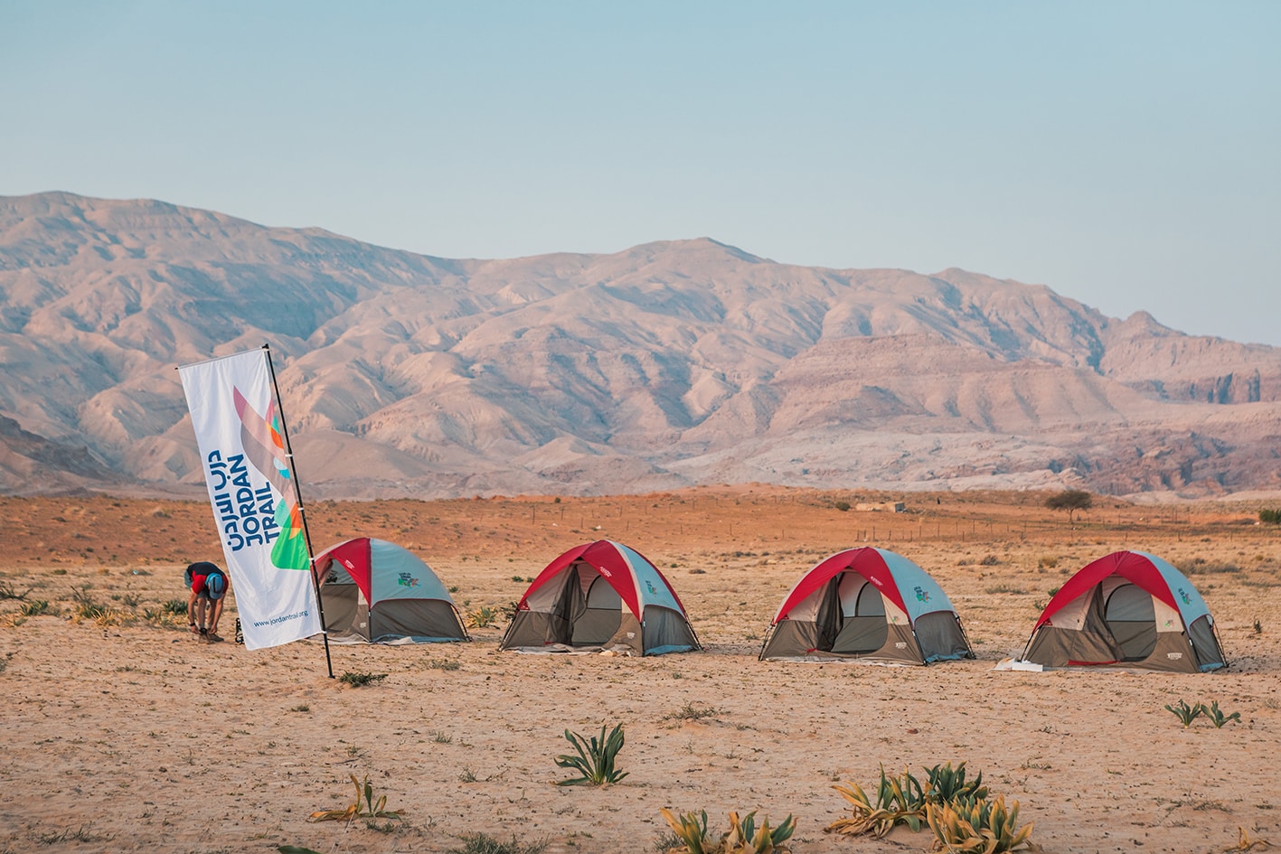
Head west to a path that reaches the much wider Wadi al-Saif, where you’ll footpath will lead you into the wadi in a southbound, upstream direction. Continue south along a 4×4 in Wadi al-Saif until you reach a large boulder in front of a huge vertical cliff of white and red sandstone, where this wild campsite spot marks the end of the stage. On the top of the rock are old (Nabatean era) carvings of animals including camels, gazelles, and sheep.

TRANSTOPTATION
  • Car access to Gaa’ Mriebed area
  • Jeep access only to Wadi al-Saif
Local Contacts / Accommodation
  • Wild camping, Hussain Saideen, +962772429759, JT Pass Stamp Wadi Al Saif
THINGS TO SEE
  • Colorful Sandstone
  • Wadi Abu al-Orouq
  • Nabatean Carvings in Wadi al-Saif
FOOD & WATER

Food:

  • None on route

Water:

  • Water from Ein Abu O’rouq and water pools in wadi near Wadi Quseib campsite (next stage)
TIPS & SAFETY

Tips:

  • Most of the day’s walking is in areas with some loose stones, sand and gravel in wadi beds
  • If hiking self-supported, camping near the water springs in Wadi Abu Orouq and Wadi Quseib on next stage make a manageable longer combined stage around 27km. Be sure to watch the weather for potential flash flood risks if camping in the wadis.

Safety Info:

  • Flash flood dangers – Wadi Abu O’rouq
  • Loose footing – Rocky, sandy surfaces and wadi beds
  • Dehydration/heat exhaustion – There is very little shade along the stage, but occasional small Acacia trees and rock overhanging the sides of wadis that can provide some shade.

Mobile Phone Coverage: Some coverage at higer areas around kilometer 8, and on top of at the end of the stage in Wadi al-Saif.

The Jordan Trail is a newly established trail, and is not marked. It is therefore our strong recommendation that you hire a local guide for your safety as many sections are remote with limited water sources and at times no connectivity.
By downloading these maps/GPX you take full responsibility for their use and accuracy; Jordan Trail Association does not warrant the accuracy or completeness of the information, materials or the reliability of any maps as they provided AS IS without warranty of any kind, either express or implied, including but not limited to, fitness for a particular purpose, or non-infringement ;You acknowledge that any reliance on any such maps, shall be at your sole risk and responsibility as Hiking, backpacking, and other outdoor activities all have potential hazards involving risk of injury or death. Outdoor activities have inherent risks and you should ensure you have the skill level and abilities suitable for the activities in Jordan to partake in them and to take all precaution measures.  Check the data on Google Earth or other Apps or Programs before using them.  The Jordan Trail Association shall not be held responsible for any incidents that may occur during your participation in any activity and/or by using any of the maps/GPX.
AGREE
close-link