


Tourism Police:
Hotline: 117777
What’s App: +962 7 7099 1814
* When contacting Tourism Police for emergency identify that you are hiking the Jordan Trail, state your nationality, location and map name & number.
JTA office: +962 6 461 0999
(Working Hours: 9:00 a.m. to 5:00 p.m., Sunday- Thursday)
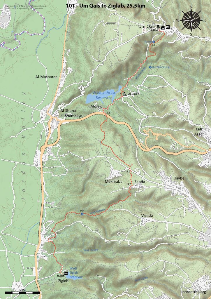
Small lanes lead N out of the village and across the upper reaches of Wadi Sir to a road rising up though wooded countryside before descending NE into the beautiful and thickly wooded Wadi Zubia. Dependent on the season there may be water in the stream. Follow the valley up until the trees thin out, revealing the cisterns and ruins of Roman Qabla up to the left. A lane then goes S up the hillside to where the main road is followed W before descending a wooded valley and hillside and crossing Wadi Orjan to reach Rasoun village and homestays.
 mohammed darwiesh
 Ali mahmoud
- King’s Royal Lodge and hunting area
- Qabla ruins
- Zubia forest, seasonal pools in Wadi Zubia
- Tor al-Ahmad Cliffs
- Dolmens
- Ajloun Reserve
- Al Ayoun Tourism
- Rasoun
Food:
- Shops in Beit Idis and Rasoun (mini-market across from municipality)
- Fruit shops on the road after Qabla (seasonal).
Water:
- Beit Idis
- Ein Zubia (purify before drinking)
- Rasoun village at end
- Various houses near Qabla
Tips:
- Enjoy the most forested day of the entire Jordan Trail, a welcome break in the shade from the hot Jordan Valley.
- Paths follow mostly gentle grades, with a manageable distance.
- Route is waymarked and used frequently.
Safety Info:
- Loose footing – Present only for short sections.
- Wise to avoid the King’s Lodge area.