To download the Jordan Trail GPS tracks, Click here..
The Jordan Trail is a newly established trail, and is not marked. It is therefore our strong recommendation that you hire a local guide for your safety as many sections are remote with limited water sources and at times no connectivity.
By downloading these maps/GPX you take full responsibility for their use and accuracy; Jordan Trail Association does not warrant the accuracy or completeness of the information, materials or the reliability of any maps as they provided AS IS without warranty of any kind, either express or implied, including but not limited to, fitness for a particular purpose, or non-infringement ;You acknowledge that any reliance on any such maps, shall be at your sole risk and responsibility as Hiking, backpacking, and other outdoor activities all have potential hazards involving risk of injury or death. Outdoor activities have inherent risks and you should ensure you have the skill level and abilities suitable for the activities in Jordan to partake in them and to take all precaution measures. Check the data on Google Earth or other Apps or Programs before using them. The Jordan Trail Association shall not be held responsible for any incidents that may occur during your participation in any activity and/or by using any of the maps/GPX.
* When contacting Tourism Police for emergency identify that you are hiking the Jordan Trail, state your nationality, location and map name & number.
JTA office: +962 6 461 0999
(Working Hours: 9:00 a.m. to 5:00 p.m., Sunday- Thursday)
BASIC INFO
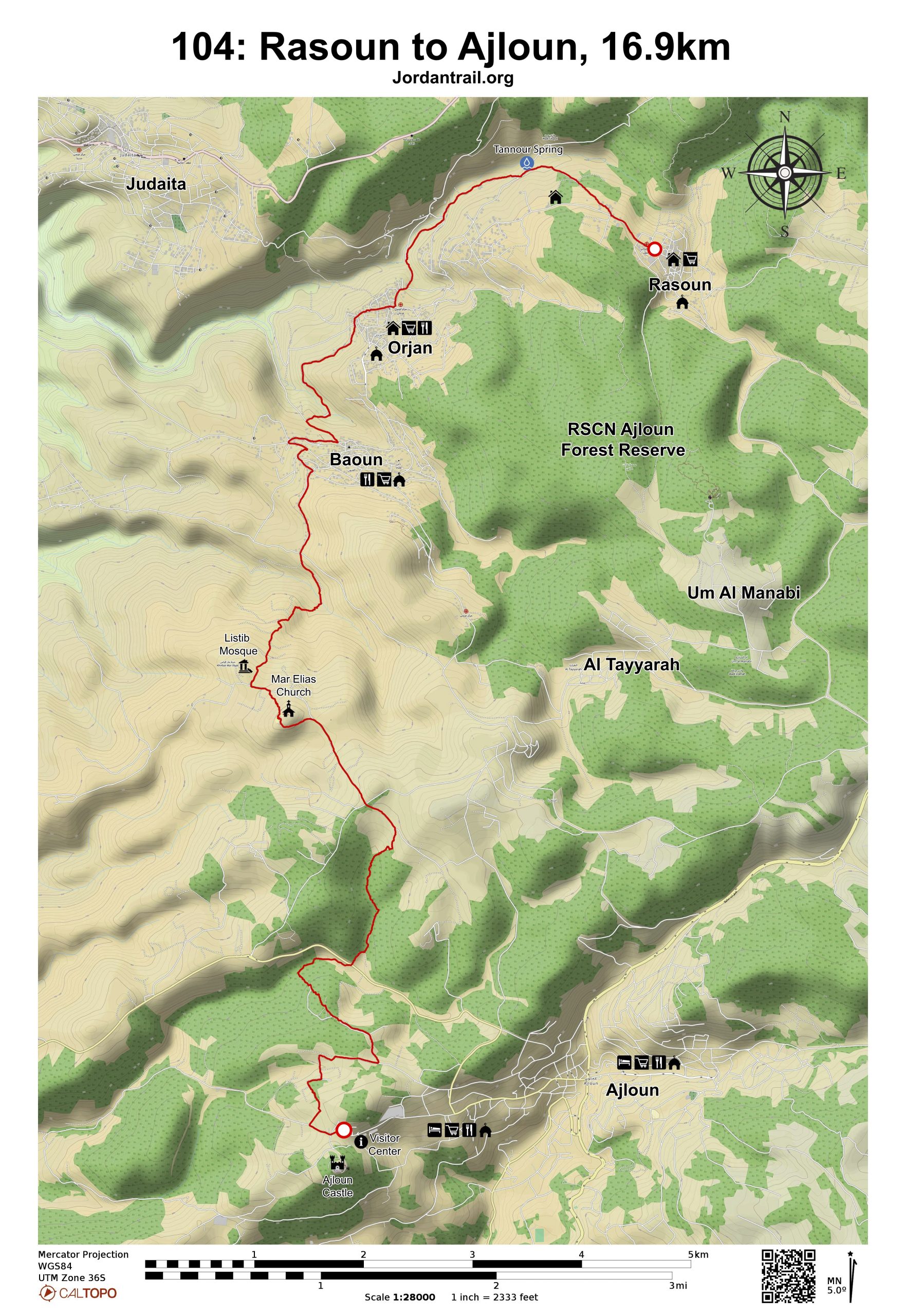
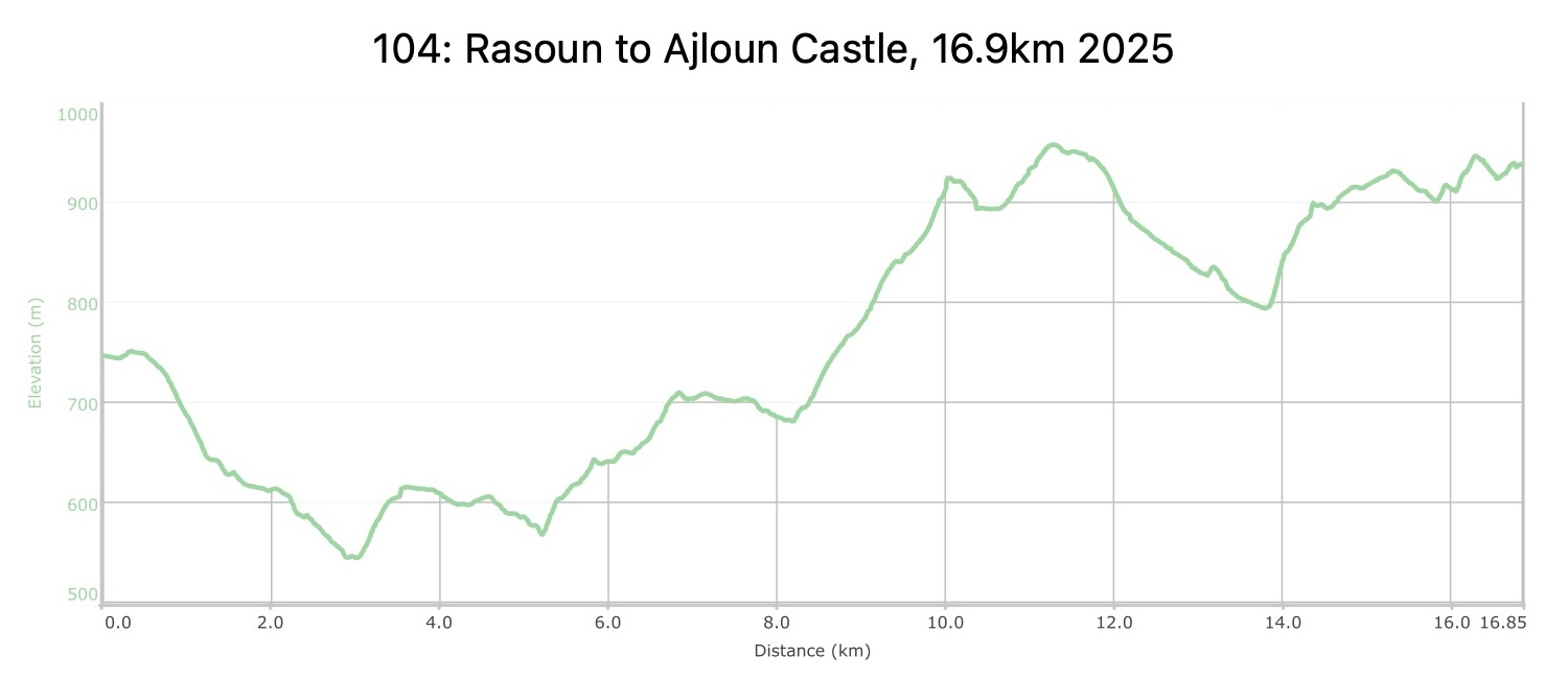
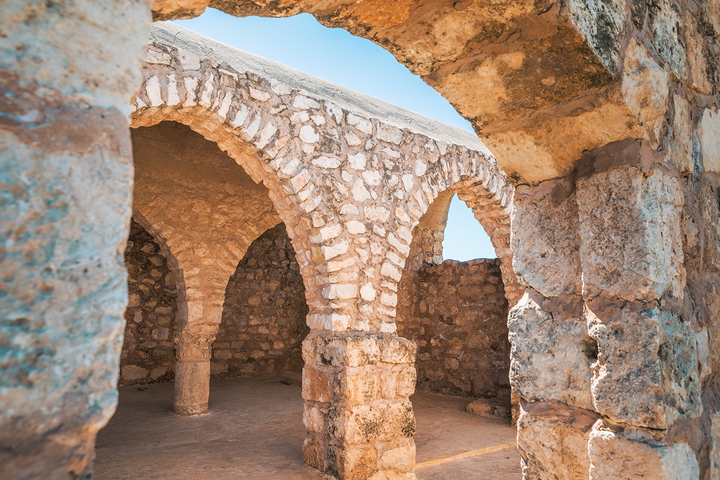
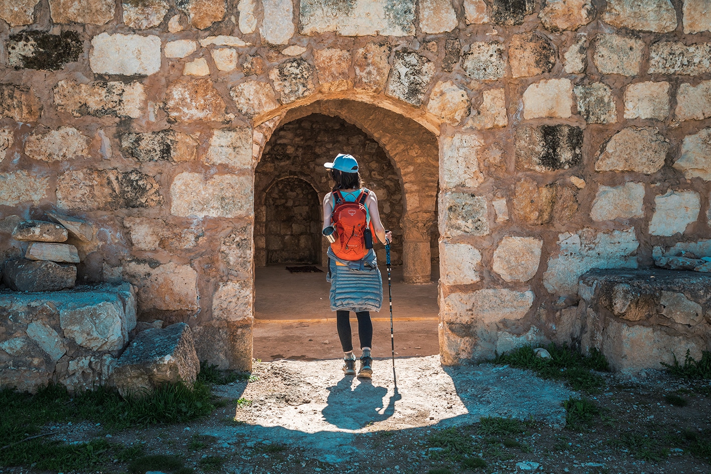
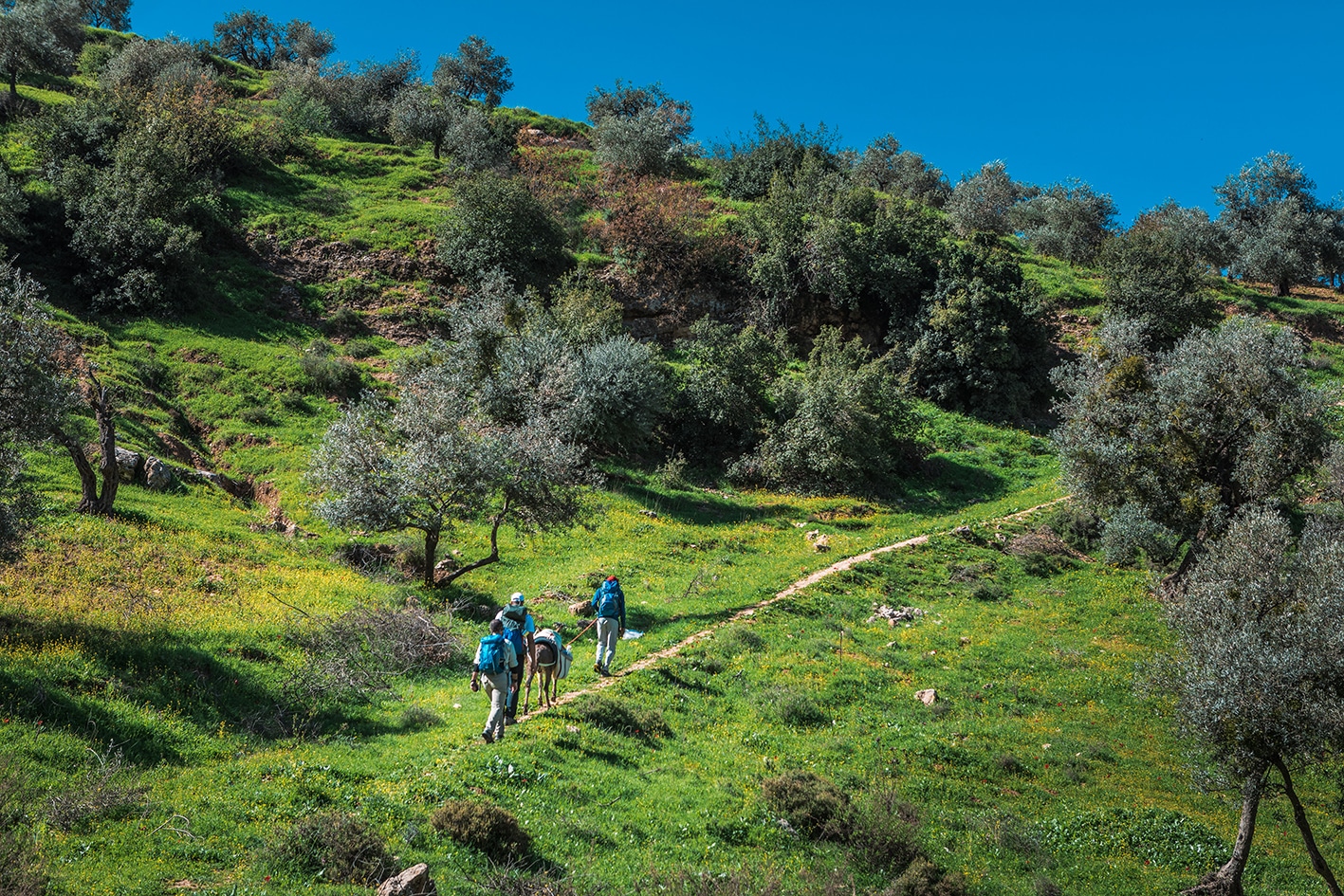
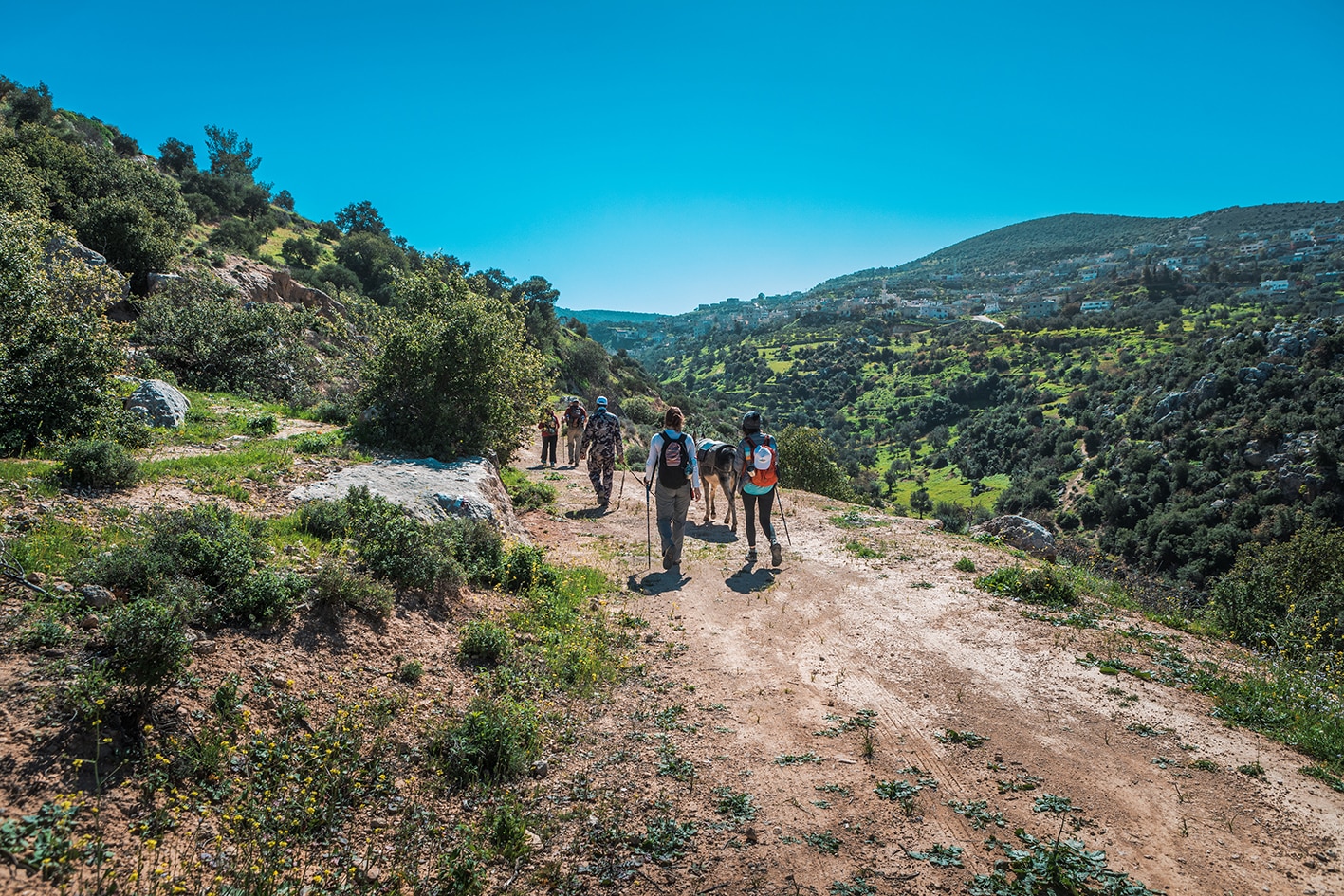
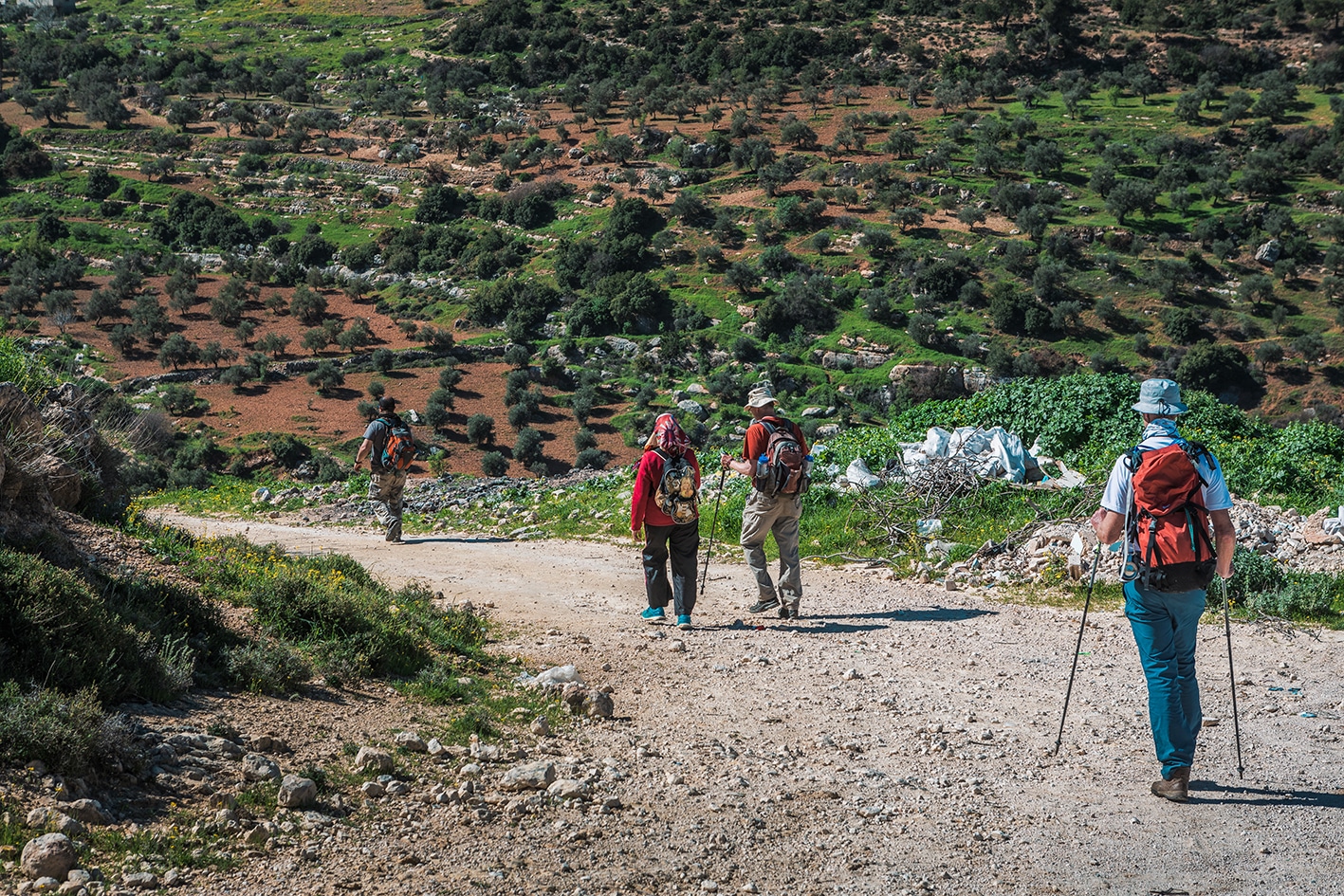
Generally easy walking today, often on country lanes through the rural villages of Al Ayoun with opportunities for a pre-arranged lunch in one of Al Ayoun’s homestays. RSCN’s Soap House and Calligraphy house are also nearby for an interesting visit. Then the walk meanders over increasingly high semi-forested hills and past the ruins of the ancient church of Mar Elyas to the Islamic castle of Ajloun on its dominating hilltop with a Visitor Centre, cafés and hotels (currently rather mediocre) in the town below.
General public transit between villages: no set schedules, buses leave when full, many routes only have private cars *service available. From Baoun to Ajloun: 5-7JD, from Rasoun to Ajloun: 7-10JD
Rasoun, Orjan, Baoun villages have small shops or supermarkets
Cafe at Ajloun Castle
Restaurant at Ajloun Hotel just down the street from the castle
Water:
Rasoun, Orjan, Baoun villages
Mar Elias bathrooms (you may want to purify)
Ajloun Castle
TIPS & SAFETY
Tips:
Bask in this pleasant day with great views, friendly villages, and a diversity of historic sites.
Route is waymarked and used frequently.
Safety Info:
Loose footing – There are just a few very short sections going up or down trail on inclines with loose footing.
Animals – Hikers may encounter shepherd dogs.
The Jordan Trail is a newly established trail, and is not marked. It is therefore our strong recommendation that you hire a local guide for your safety as many sections are remote with limited water sources and at times no connectivity.
By downloading these maps/GPX you take full responsibility for their use and accuracy; Jordan Trail Association does not warrant the accuracy or completeness of the information, materials or the reliability of any maps as they provided AS IS without warranty of any kind, either express or implied, including but not limited to, fitness for a particular purpose, or non-infringement ;You acknowledge that any reliance on any such maps, shall be at your sole risk and responsibility as Hiking, backpacking, and other outdoor activities all have potential hazards involving risk of injury or death. Outdoor activities have inherent risks and you should ensure you have the skill level and abilities suitable for the activities in Jordan to partake in them and to take all precaution measures. Check the data on Google Earth or other Apps or Programs before using them. The Jordan Trail Association shall not be held responsible for any incidents that may occur during your participation in any activity and/or by using any of the maps/GPX.