REGION1: UM QAIS TO AJLOUN

  • Details

    In the most northerly and greenest part of Jordan, the hills and canyons are packed with the ruins of many ancient civilizations. The fertility of the hot Jordan Valley, the grasslands on the hills above it, and the oak forests of the highest mountains provide an enchanting natural backdrop to the trek between historic sites from the past two millennia and beyond. Hot springs, huge ancient olive trees, caves, mysterious prehistoric structures, Roman cities, and villages pioneering community-based tourism are some of the attractions of this northern corner of Jordan.

    4 days Lenth: 80 km

  • Main sites in the region:

  • Ruins of Roman Decapolis cities at Um Qais and Pella

  • Byzantine monastery ruins at Tel Mar Elias, traditional birthplace of the prophet Elijah

  • Community tourism and rural scenery in the al-Ayoun villages

  • Medieval mountaintop site of Ajloun Castle

To download the GPS track,  Click here.. 
Click Icon

The Jordan Trail is a newly established trail, and is not marked. It is therefore our strong recommendation that you hire a local guide for your safety as many sections are remote with limited water sources and at times no connectivity.
By downloading these maps/GPX you take full responsibility for their use and accuracy; Jordan Trail Association does not warrant the accuracy or completeness of the information, materials or the reliability of any maps as they provided AS IS without warranty of any kind, either express or implied, including but not limited to, fitness for a particular purpose, or non-infringement ;You acknowledge that any reliance on any such maps, shall be at your sole risk and responsibility as Hiking, backpacking, and other outdoor activities all have potential hazards involving risk of injury or death. Outdoor activities have inherent risks and you should ensure you have the skill level and abilities suitable for the activities in Jordan to partake in them and to take all precaution measures.  Check the data on Google Earth or other Apps or Programs before using them.  The Jordan Trail Association shall not be held responsible for any incidents that may occur during your participation in any activity and/or by using any of the maps/GPX.
AGREE
close-link
to download the map

REGIONAL TRANSPORTATION

Ajloun can be reached from Amman or other large towns by public buses; as always in Jordan, these do not follow a schedule but leave when full. Transportation to the rest of the points on the trail is less reliable, though minibusses do run irregularly along the Jordan Valley highway, passing near Pella. Private taxis are nearly always an option in the region. The bus journey between Amman and Ajloun is about 1.5 hours once the bus leaves and costs about 1JD

For more information on transportation in Jordan, click here.

Accommodations

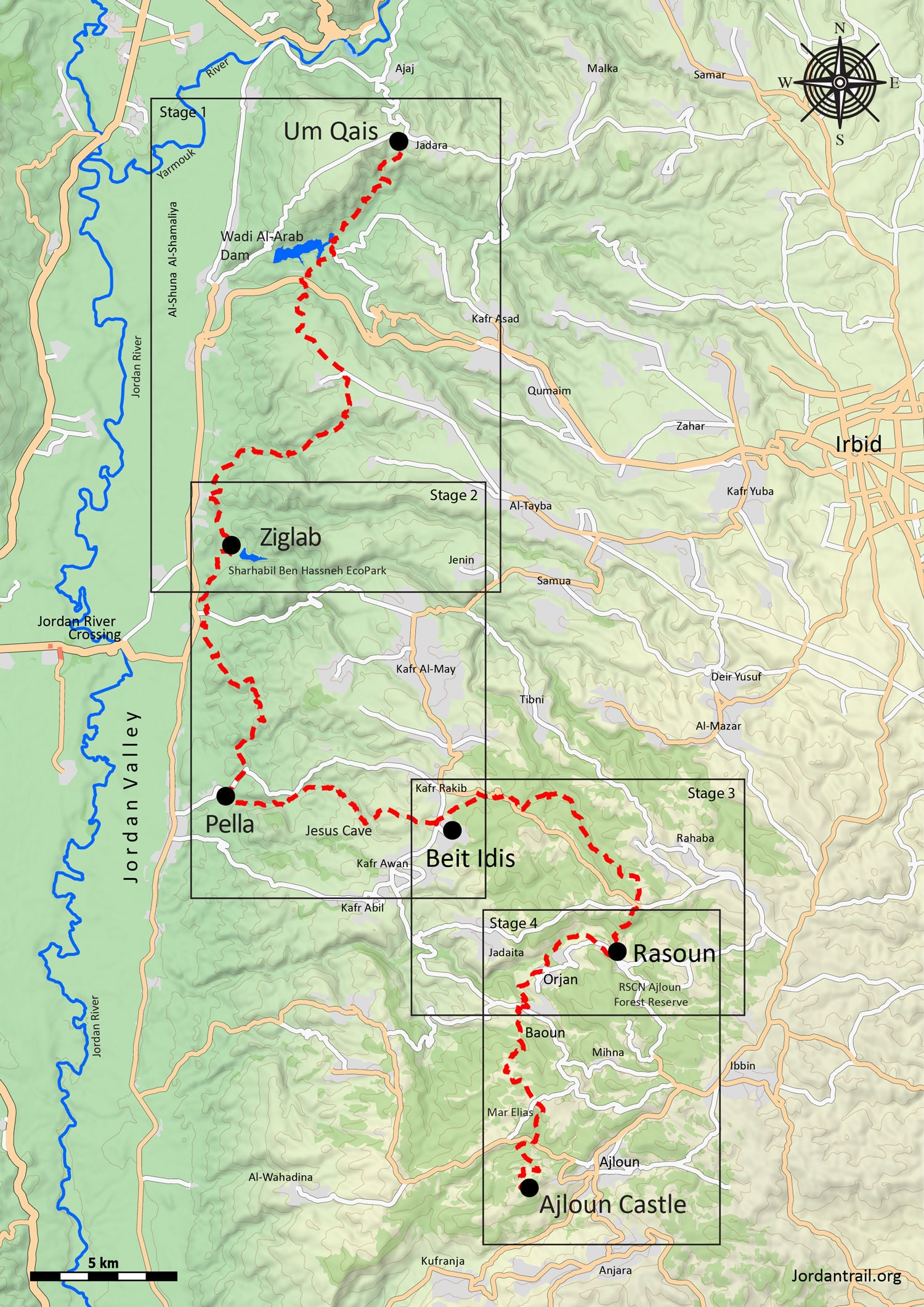
Accommodations are available throughout the region in the form of guesthouses or hotels, near Pella, and in Ajloun; family stays are also available in Beit Idis and in particular in Orjan, Baoun, and Rasoun, where many families are prepared to host travelers. Family stays operate something like a bed-and-breakfast in a family’s home, including dinner and breakfast and a packed lunch, and are generally a very social experience. The al-Ayoun region is the hub of this form of community-based tourism in Jordan and offers a unique experience for travelers who are interested.

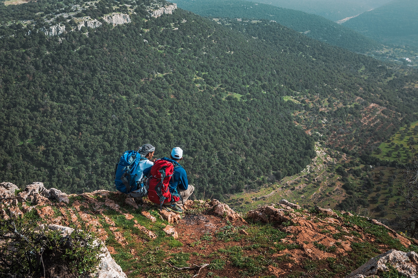
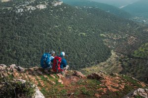
Wild camping is also possible, particularly in the forested hills around the al-Ayoun area. As always, remember to keep away from private property and follow Leave No Trace practices

The Jordan Trail is a newly established trail, and is not marked. It is therefore our strong recommendation that you hire a local guide for your safety as many sections are remote with limited water sources and at times no connectivity.
By downloading these maps/GPX you take full responsibility for their use and accuracy; Jordan Trail Association does not warrant the accuracy or completeness of the information, materials or the reliability of any maps as they provided AS IS without warranty of any kind, either express or implied, including but not limited to, fitness for a particular purpose, or non-infringement ;You acknowledge that any reliance on any such maps, shall be at your sole risk and responsibility as Hiking, backpacking, and other outdoor activities all have potential hazards involving risk of injury or death. Outdoor activities have inherent risks and you should ensure you have the skill level and abilities suitable for the activities in Jordan to partake in them and to take all precaution measures.  Check the data on Google Earth or other Apps or Programs before using them.  The Jordan Trail Association shall not be held responsible for any incidents that may occur during your participation in any activity and/or by using any of the maps/GPX.
AGREE
close-link